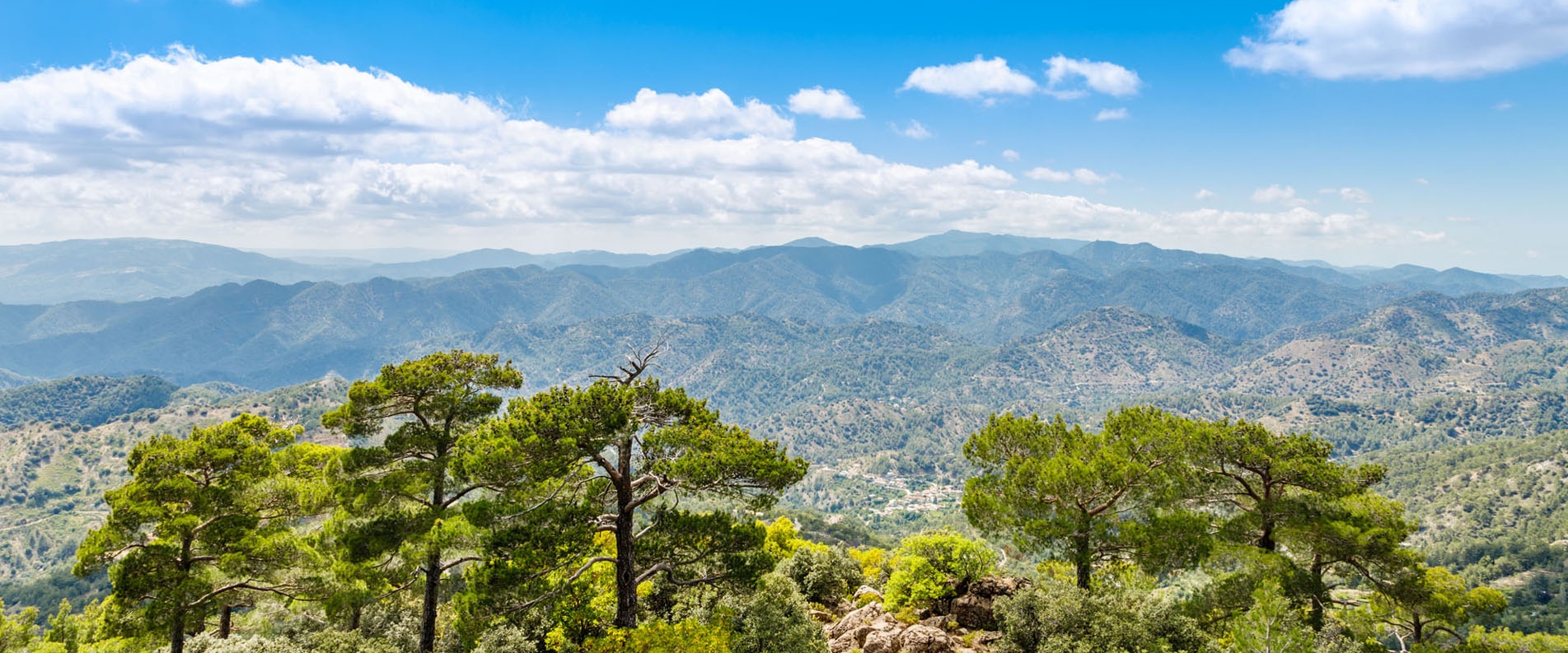
Ah…. I wish I could name this article “alpinism and mountain climbing in Cyprus”, but alas, the local “Everests” have yet to grow to such heights. And that’s despite the fact that a large part of the island is occupied by mountains. But if we focus on the word “alpinism”, then I definitely wouldn’t strike off Cyprus’s mountain peaks. The ascent to these summits isn’t a “call to nature”, nor a “test of your worth”, but rather a “classic hike to a picnic spot”. That said, the “picnic spots” at these summits can be truly marvellous. As a rule, the mountain summits on the island overlook some absolutely jaw dropping panoramic views.
Also, I suppose that visiting all the main peaks of Cyprus is one of the best ways to learn about the island in all its multifaceted forms. Today, we’re going to speak about which mountains are the tallest and which of them are a must-climb.
Olympus
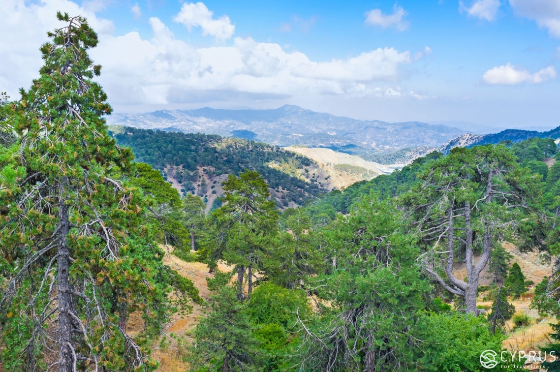
No doubt, the main mountain in Cyprus. Towering at a height of 1,952 metres, it’s visible from almost any point in the country. The air temperature here dramatically differs from what’s observed below. Regardless of where you are on the island, there’s more precipitation on Olympus. Nature here is different; for example, there are lots of endemics that can only be encountered at the mountain’s summit. Starting at a height of 1,600 metres, the natural landscape typically begins to make an abrupt change. The standard, feeble, unremarkable conifers surrender to extravagant black pines and Cyprus cedar. From below, the “strawberry trees” look like bushes, while at the mountaintop, they are robust giants.
The structure of the earth also changes. The higher you venture, the more the soil turns into “stony crumbs”, and the local vistas begin to resemble Martian plains.
Lo and behold, these transitions are most noticeable on Olympus. Not only is the mountain the tallest, but it’s also very large. With a gentle slope.
The very top of Olympus is inaccessible, as there’s a military base located there. That said, you can almost ascend to the very summit. For this, you’ll need to drive 200 metres along the asphalt road located behind the cafe. Afterwards, drop your car, walk to the right and then a little ahead. At some point, you’ll find yourself by a lift— this is the highest accessible point. It overlooks the north of the island. Like I said, the slopes are rather flat, so I can’t say that the view is ideal. But it’ll do perfectly fine for a picnic.
Aside from the summit, Olympus features several other points of interest. The first is the fork at the E910, where one road heads towards Prodromos, while the other veers left towards a ski resort. There’s a specially equipped viewing platform directly next to the fork, where tourists are carted and then told the flagrant lie: “you can’t go any higher, so observe the view from here”. The platform really is great, and reveals some awesome views. It’s also invisible from the roadside. If you drive past — you won’t notice it.
Another fascinating option is going for a stroll along the closed-loop walking routes. One is located near the ski resort. To get to it, head behind the coffee shop, walk several metres, find the trail and head along it to the right. It’s a tiny route, only two to three hours long. On the bright side, it has a lot of scenic spots overlooking the south side of the island. You can gaze all the way out to sea. Benches are often set up in the best spots.
There’s another route that’s longer and lower down. But just because it’s lower, don’t think it’s any less amazing. It might just be more of a sight to behold. The entrance to the trail is next to the CYTA building in Troodos village. To the left of it. Set aside at least 5-6 hours for this walk.
Although Olympus is the tallest mountain on the island, the best views need to be sought out at other summits. That said, it’s not worth forgetting about the “brother of the Greek Olympus” — visiting here is a must. The value of this summit is not in its views, but in the absolute uniqueness of its natural landscape.
Madari
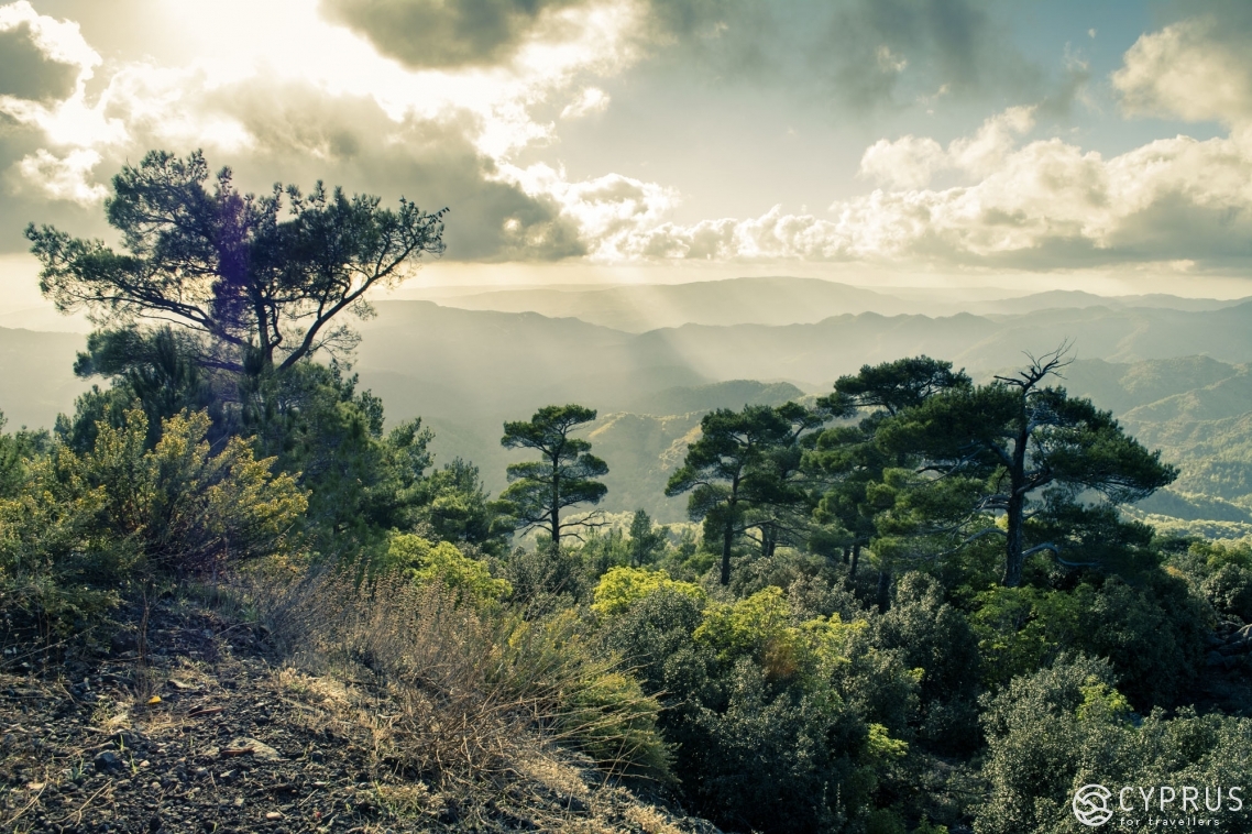
The mountain is significantly smaller than Olympus — at a height of 1,613 metres. However, when you’re at the summit, you don’t feel the difference. Madari’s peak is a steep incline, so nothing gets in the way of the panoramic view. These are perhaps the best vistas in Cyprus.
You can reach the summit either by foot, along a specially constructed tourist pathway, or along a narrow asphalt road stretching from Kyperounta. The road practically goes all the way to the summit, and features a small parking area at its end.
There are two observation points on the mountain. The first is a fire station located at Madari’s summit. You can always find a fire fighter on duty checking on watch from above, checking that no smoke has appeared anywhere.
As a rule, the firefighters are friendly and don’t object to tourists climbing up to their level to marvel at the local views.
The second viewpoint is more intimate. It’s located a slight way away. You can get to it heading along the pathway that leads to the left from the car park. You walk for roughly two hundred metres along the mountain ridge and end up at a small area equipped with a bench. The spot reveals a more fascinating view than what you can find at the fire station, despite the latter being situated a little higher. This is because the area with the bench lies on the ridge, so the viewpoint travels down the valleys along both sides of the ridge. In the north, you have wooded mountains which get smaller the further you go. When standing dozens of kilometres away, the mountains turn into meadows, while the flat plains reach all the way to the sea. And when visibility is good, this is all perfectly distinguishable.
To the south of the ridge, there’s a small valley which houses the scenic village of Kyperounta.
In my eyes, the summit of Madari mountain is simply the ideal place for the best romantic date ever.
Tourists are rarely seen here. There’s usually no one at the top, aside from the on-duty fire fighter. But one of the tourist companies drives people here who wish for a ‘safari tour’. That’s why you can sometimes encounter a whole crowd of people here. But their stop at Madari isn’t a long one. Half an hour and the entire cavalcade will trot off back.
Tripylos
This summit towers at a height of 1,362 metres. I’m almost certain you’ve never heard the name Tripylos. And if you have, it’s not concerning a mountain, but in reference to a national park.
Tripylos mountain isn’t too popular. Firstly, it’s located in a remote and isolated part of the island. Secondly, unlike Kionia peak (mentioned below), its splendid silhouette doesn’t sparkle from afar. The E740 runs next to the mountain. But if you’re driving along it, you’ll be none the wiser to the fact you’re driving past the fifth largest mountain peak in Cyprus. What’s more, there aren’t even any tourist paths on the peak itself.
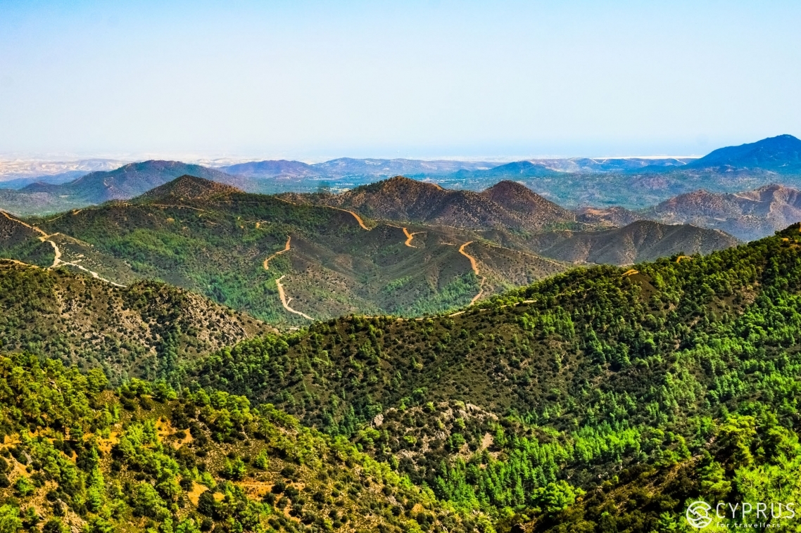
What’s up above? Well, I wouldn’t say there are any super impressive views that will make you feel like sobbing romantically without restraint. It’s mainly mountain terrain, aside from the Cyprus cedars which fall into the bracket of interesting and beautiful. They are magical, fluffy, majestic trees.
Why else is Tripylos a point of interest? The mountain is part of the eponymous national park, meaning the scenery here has practically never been tarnished by human activity. Aside from the E740 road (which you can occasionally drive along for half an hour and not cross paths with a single car heading in your direction) and a couple of lower-class roads, you won’t discover any traces of human presence for dozens of kilometres in every direction. However, you will come across mouflons, as this is their nature reserve, but seeing one of them is no easy task. I’m sure that many indigenous island residents have never seen one in the wild. That said, sometimes you can get lucky and an entire herd, stretching for tens of metres, will run past you.
Plus, endemics grow here, and the natural landscape is generally rather luxuriant. However, it’s not too expressive, especially considering that relatively close to the peak lies Cedar Valley — a place widely renowned in the country. If you’re going to head up Tripylos, make sure you call at the valley, as the natural landscape there is definitely expressive.
Kykkos
While at a height of 1,318 metres, it’s only the sixth tallest island peak, Kykkos is the most sacred. You probably know that there’s a monastery on the mountain bearing the same name. The most famous, most popular amongst tourists, and the wealthiest. It houses the icon of Virgin Mary.
So, we’ve got to grips with the monastery. What about the views? For those, you need to drive a little further. If you’re heading to Kykkos monastery from Nicosia, there’ll be a fork at the very entrance. The road to the right leads to the monastery car park. But we need the road to the left. We drive for around two minutes along a well-paved asphalt road, climbing higher, and find ourselves at the upper viewpoint. We park up and walk to the right. At the very top lies the tomb of the first president of Cyprus, Archbishop Makarios.
President Makarios is loved and revered in the country, so everything here has been fashioned in a grand and very splendid manner. There’s a cobbled road heading upwards. On either side of the road, there are hundreds of mosaics depicting saints. The territory is regularly washed and tidied — it’s impeccably clean here. The tomb stands at the highest point, surrounded by marble ledges. Obviously, this isn’t a place for a picnic. But it’s nice to visit the summit, with a 360 degree view. That being said, the sea isn’t in sight, and you can mostly see only the nearest mountains and valleys. Still, the view is still spectacular.
It’s also fascinating to look at the tomb. Sometimes, people are let inside.
Papoutsa
At a height of 1,554 metres, it’s the third largest peak in Cyprus. You can ascend to the summit from the north and south-west. There’s a rather popular route amongst fans of walking tourism. The journey from the road will take you roughly 45 minutes.
Despite being in the TOP 3 Cypriot peaks, there’s no fire station, nor radar or observatory installed on Papoutsa. That’s why you can get to the very peak unimpeded, and enjoy the mountain’s nigh on pristine nature. I say “nigh on” as there’s a relatively small cross positioned there.
Golden oak grows at the foothills of Papoutsa. If you head higher, there are only bushes. The mountaintop is bare, but don’t think that means there’s nothing to see. The vistas here are will blow your mind. You can observe a number of delightful villages lying down below, or even make out the southern coast from high above. It’s definitely worth visiting this spot at least once in your life.
Kionia
The mountain stands at a height of 1,423 metres. It’s the fourth tallest peak in Cyprus, and the easternmost. This mountain summit is perhaps the most recognisable, and I reckon it’s been spotted from afar by anyone and everyone driving along the Limassol - Nicosia road. This peak is the last in the Troodos mountain range. Afterwards, the mountains become smaller and smaller, turning into flat plains. That’s why Kionia is so visible from a distance, especially from the the island’s eastern flats in Nicosia district.
You won’t be able to get to the very top of the mountain as the road is closed. There’s yet another “giant golf ball” — a radar or observatory… However, there’s a picnic area near the summit. For residents of Nicosia, this is the closest spot to grab some cool air.
The vistas overlooking the mountain are indescribable. Added to that, you can observe the beauty of the valleys by driving to the summit along the road.
We’ve spoken about the tallest mountains in the local area. They’re all of particular interest and all a must visit for anyone who loves walking tourism. However, I don’t feel like ending the article here. There are other, smaller peaks that possess, in a similar vein, a unique beauty and inimitable quality. After all, for jaw-dropping views, the rule “the higher the better” doesn’t always work. More often than not, it’s even the opposite. It’s not the height of the peak that’s important, but what lies around it.
Let’s take the village of Pissouri. It’s not even located in the mountains, but simply on some hills, standing a mere 300 metres above sea level. However, thanks to the hills being surrounded by a flat plain valley from three sides (the fourth side exits into the sea), practically any person living here can boast that the views from their window would make you shed a tear. Therefore, let’s introduce several other classic spots on the map to our list.
Moutti tis Sotiras
Although this little mountain reaches only a tad over three hundred metres, it reveals what are easily the top three best views on the island. It’s all a matter of location. The hill is located in Akamas nature reserve, a rather large (for Cypriot standards) peninsula — a section of wild land. Well, it’s not completely wild, as in some spots, the locals have crammed in a bunch of fixer-uppers. On the whole, however, it’s one of the wildest areas on the island.
The uniqueness of Akamas lies in its beauty. Its rocky, indented coastline, stunted trees, pine forests here and there, as well its scenic bushes and grass plains. Also, her Highness the Blue Bay - one of the most sought-out beaches for Cypriot residents, and simultaneously one of the least accessible. The bay stands in a league of its own, thanks to its clear, transparent, turquoise water, which is completely unheard of for this part of Cyprus.
Moutti tis Sotiras reveals a panoramic view of the peninsula’s most beautiful part, including the Blue lagoon. The view is so marvellous that it’s often encountered on postcards dedicated to Cyprus (alongside the sights of Ayia Napa).
The only issue with this place is it’s rather difficult to get here. The road is so dire that many a four-wheel isn’t up to the task, whereas for standard cars, it’s a 100% no go. When I say “road” — this is blatant flattery. It’s closer to a cluster of vegetation stripped of any rock formations. There are occasions when you have to somehow manoeuvre between two metre-high boulders. Sometimes the ascent is so radical that not every engine can cope with the strain. I once came to Moutti tis Sotiras in a rental buggy. It was an absolute nightmare, but the buggy playfully dealt with all the obstacles it faced — I’m still in awe of how great those vehicles are at crossing terrain.
If you don’t have a buggy at hand, your best option is going on foot. The blessing here is that there are several popular tourist trails in the vicinity. The shortest route is along the Aphrodite Trail Rastbank, which you can get to after reaching the “Baths of Aphrodite”, a questionable tourist attraction. Despite this place not having a single shred of uniqueness, you’ll easily be able to pick it out on a map, as it’s extremely popular amongst tourists. The distance from the “Baths” to Moutti tis Sotiras is a little over two kilometres.
Saint Hilarion Castle
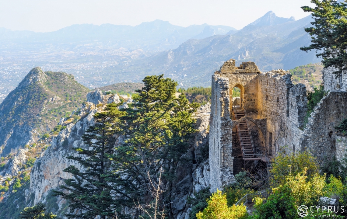
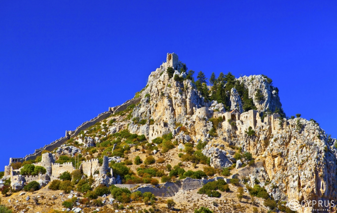
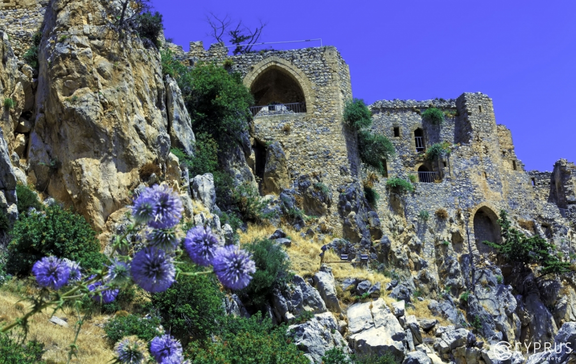
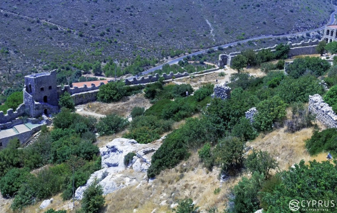
Why has there been a whole list of descriptions about mountains, and suddenly a castle pops up? The castle is situated on a mountain, but no matter how hard I try to find the name of this hilly mass - I can’t for the life of me find it anywhere; merely a vague reference to “one of the slopes in the Kyrenia mountains”. Therefore, for the sake of defining this spot, it will simply be a castle. What’s more, it’s one of the major hidden gems in these parts.
The spot is located on the occupied territories of Cyprus, in the west of the Kyrenia mountains.
Kyrenia is the second largest massif in Cyprus, and since we’re talking about summits, it would be a sin not to visit this location.
Kyrenia is perceptibly lower than Troodos. Its tallest mountain is a little over a kilometre in height. However, owing to its geographical peculiarities — Kyrenia is a ridge which has sprouted amongst a set of flat plains — if you want some amazing views, its one of the best spots on the island.
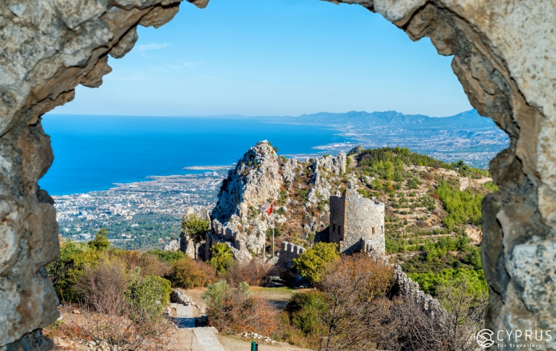
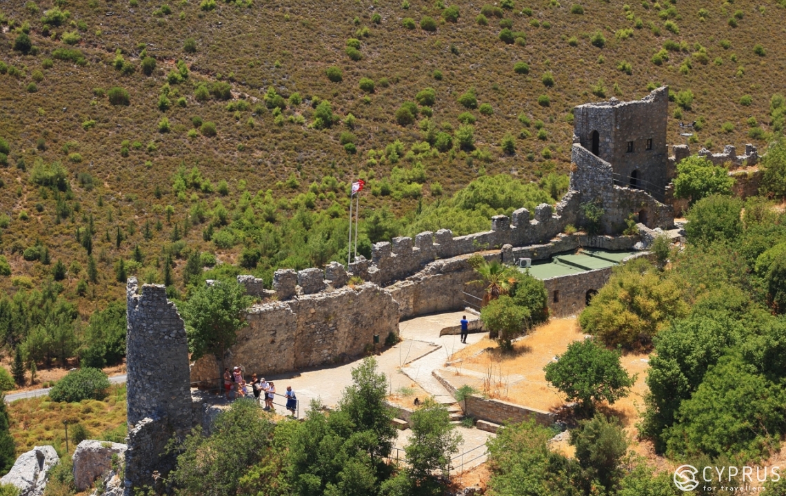
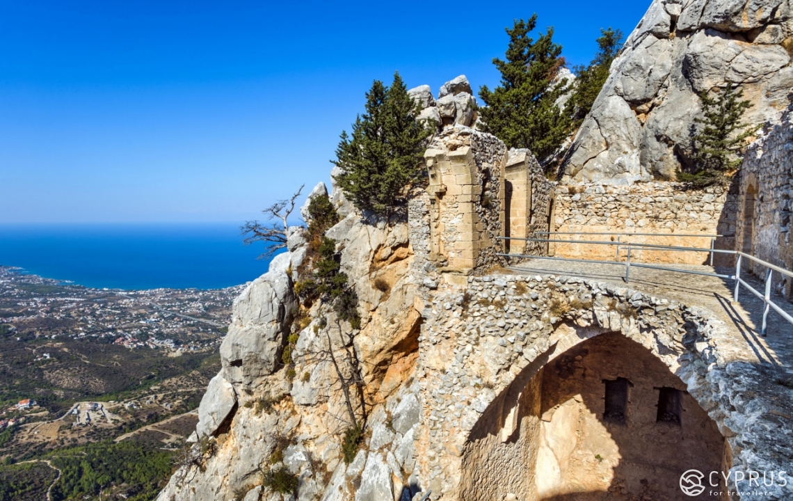
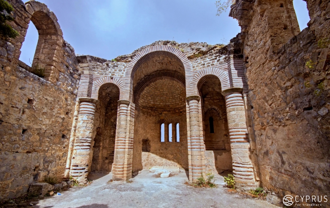
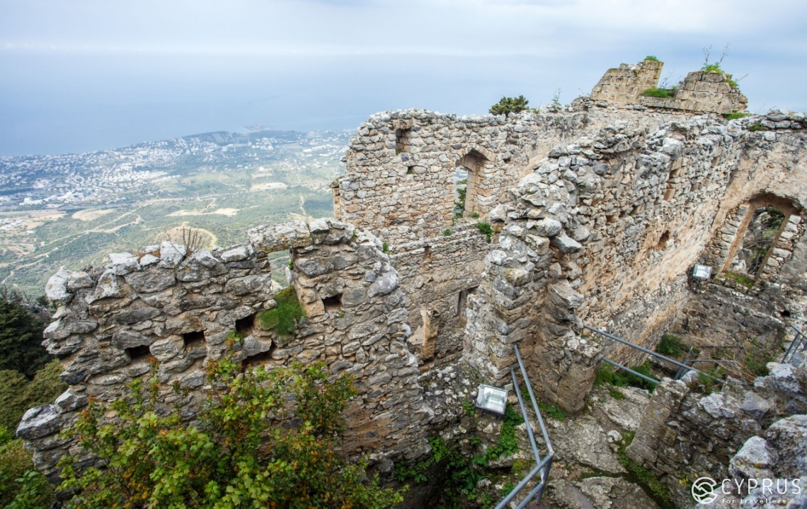
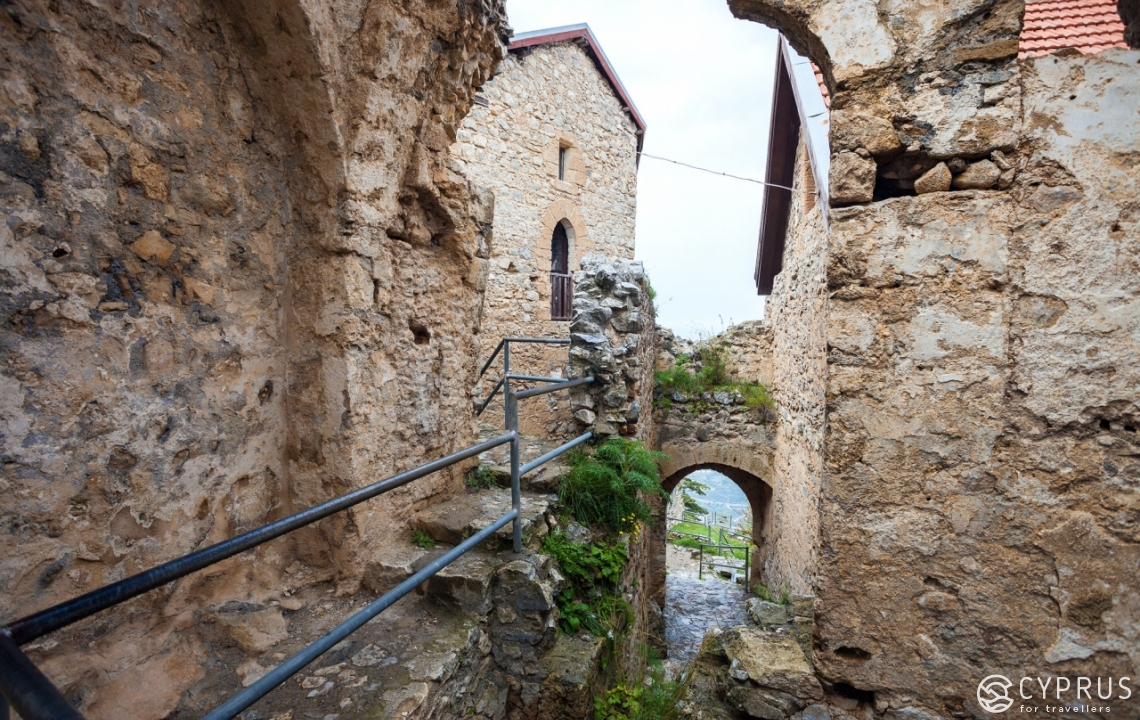
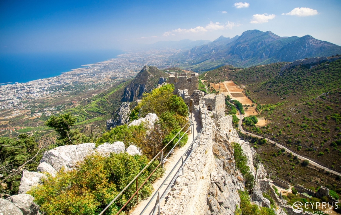
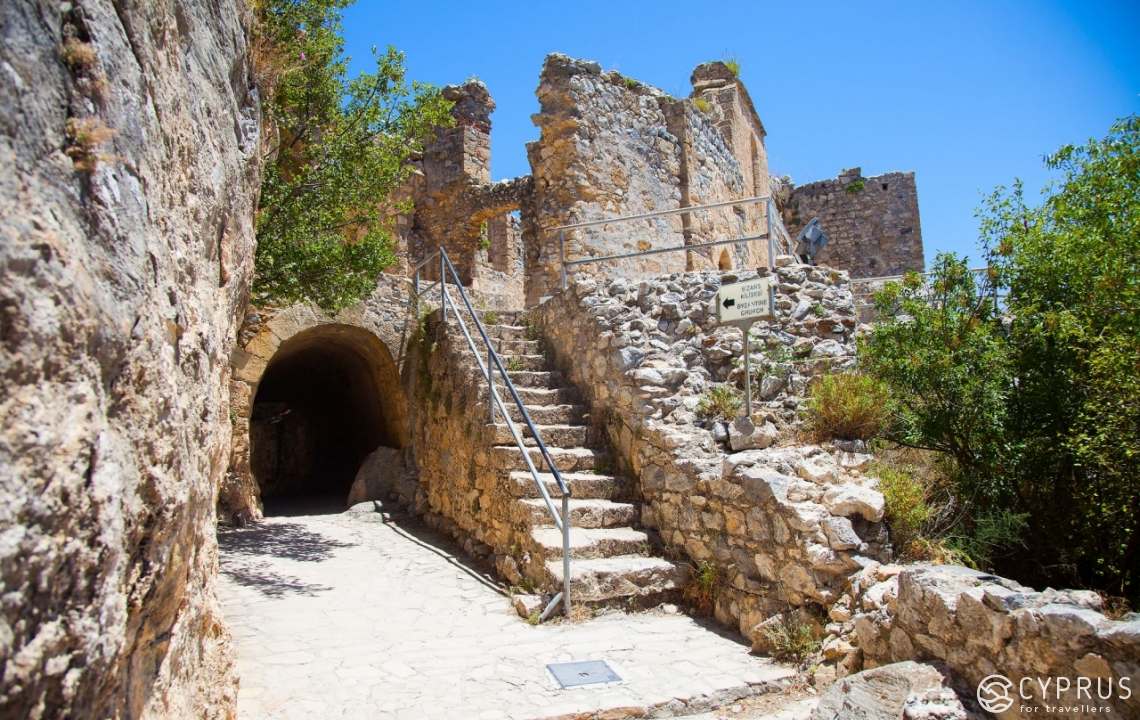
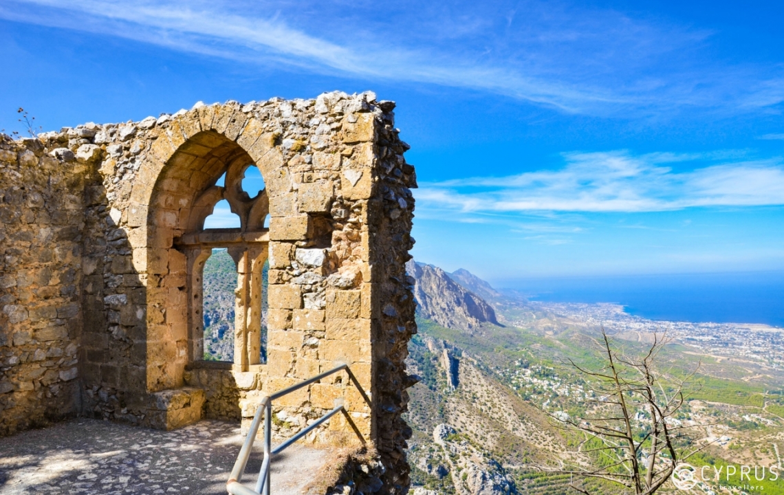
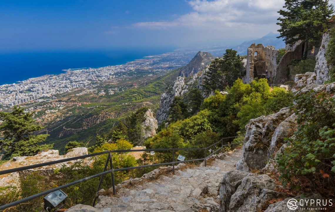
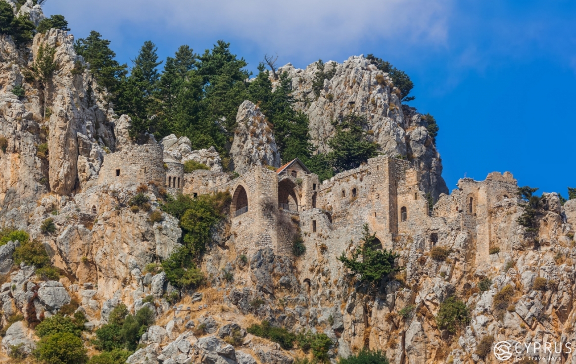
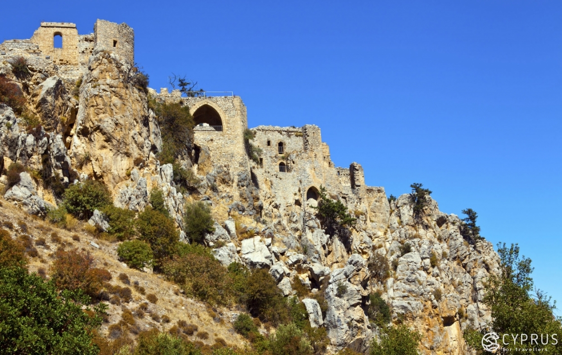
As for Castle Hilarion, it’s positioned on the mountaintop at a rough height of 700 metres. In fact, it’s not simply a castle, but an entire medieval town built on a mountain, which has remained decently preserved to the present day.
The town itself is a fabulous spot to immerse yourself in the atmosphere of bygone ages. The windows of the ancient buildings reveal a marvellous view of the city of Kyrenia. At the uppermost part are the royal chambers — the highest observation point. It’s open and provides a 360-view of the area. To the north — also a view of Kyrenia and its vicinity; the south — a view of the castle from above, while the east and west reveal a set of mountain peaks.
There’s a superb asphalt road leading up to the castle. To the entrance. Afterwards, you get out of the car, pay for entry (you won’t get in for free) and head higher on foot. I have to say, this isn’t the simplest of hikes. There are stone or metal steps galore, but they’re rather steep. It’s pretty much impossible to reach the very top without breaking a sweat or becoming short of breath. But it’s definitely worth it.
Kyparissovounon
A little over a kilometre in height, it’s the tallest mountain in the Kyrenia ridge, located on the north-west of the island. The road to the summit can’t be seen on google maps, but it is there, and it’s asphalt for the most part. It leads right to the top. That said, it’ll be impossible to get there, as once again, it’s an “important, off-limits site”. However, the views from the roadside are nothing to sniff at, and you can drive along the top of the mountain ridge taking in the kaleidoscope of picture-perfect vistas. At the end of the road, the museum of tanks awaits.
However you put it, visiting the uppermost northern point of the island is an absolute must see.
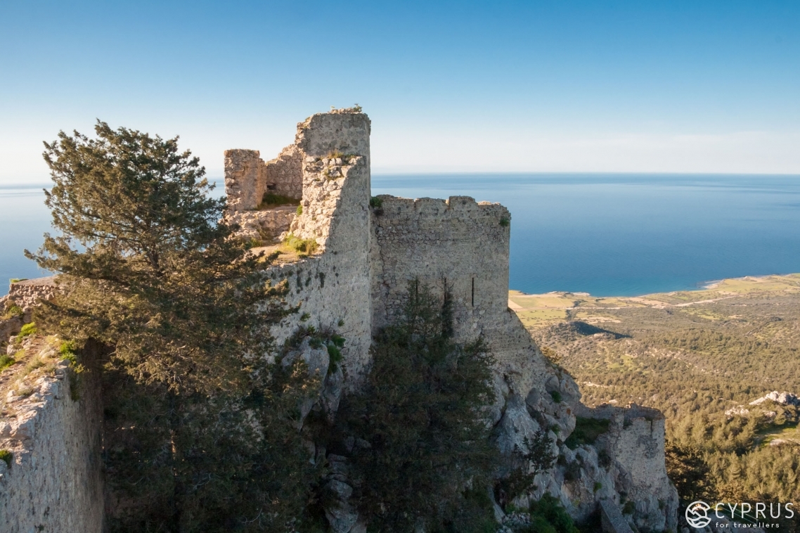
Kantara Castle
And to complete our list, another curious spot amongst the Kyrenia mountains — Kantara Castle.
Please allow me to take you on a short historical excursion. The Kyrenia mountains are a naturally formed wall passing through the entire island, from the east to the west, along the coastline. It would’ve been a sin not to utilise the mountain ridge to protect and defend the island from invited guests. That’s why, in the middle ages, a number of impregnable castles were constructed atop many mountain summits along Kyrenia ridge. And just like in the film “The Lord of The Rings”, when the island was approached by an enemy, the nearest castle would ignite its signal fire. Other fortresses would also then light their fires in a chain. As a result, very quickly, within a literal instant, everybody became aware of the enemy drawing near. And they all managed to prepare themselves. The defensive complex was powerful and effective.
Those times have long since passed, and the purpose of castles has been lost somewhere behind yet another turn in history. They’ve gradually turned into ruins that are of no use to anyone. While Castle Hilarion (mentioned above) has turned into a tourist attraction and is preserved in some semblance, the rest of the fortresses are merely a pile of rubble, and the wind wantonly brushes across their stained, graffiti-ridden medieval walls. However, there’s also a pro to these ruins. Practically no tourists find their way here, and you can enjoy the splendid views in solitude. If someone does come, you’ll certainly notice them from the mountainside. Because you can only approach here from the south.
Kantara Castle, in particular, is a fine spot for many reasons. It reveals a view to both the north and south all at once. The north will show you a small piece of flat plains between the mountains and sea, while the south provides you with a very select look over the endless fields and wild lands between the Kyrenia ridge and Troodos massif. You get a particular rush from being able to observe Ercan airport. Nothing will get in the way of you marvelling at this sight to behold, and the view goes on for dozens of kilometres. That’s why, while you’re sitting at the top, you can see airplanes taking off and landing somewhere down below, sparkling in the sunlight.
Now that’s definitely everything. We’ve conquered all the major and significant summits in Cyprus, so know we can brand ourselves Cypriot “mini snow leopards”— this is the name given to those who have scaled five seven-thousand-metre peaks. We only have thousand-metre peaks, so we’re mini, instead of fully-fledged snow leopards.
The mountainous part of the island greatly differs from areas with flat plains. From a natural and architectural standpoint, as well as due to its beauty and the lifestyle of the people who inhabit it. For me, “the only thing better than mountains is mountains”. And to visit all the summits is a more than ample goal for the upcoming season. We wish you all some fresh pine air, a cool mountain breeze and the incredible beauties of the Cypriot outdoors.
See you next time!

