…One day, we decide to turn off the well-known Nicosia-Agros motorway and continue on our journey (See: On the Road to Klirou. Part One: Arediou, Malounta and its Vicinity).
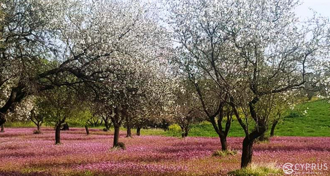
Our destination is the village of Klirou — once a settlement of clerics, it is known for its breathtaking hilly landscapes, lying above the azure expanse of the reservoir. Small pink meadows bloom in the spring air, under white clouds of blossoming almonds far away from the beaten tracks.
These territory edges will, perhaps, surprise you even further with something you have not seen.
We last left you to survey the sights in Agios Ioannis. This time we headed together to Klirou, with a preliminary visit to the local reservoir pencilled in.
Our destination turned out to be a rather exciting place…
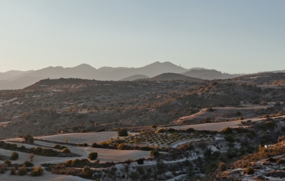
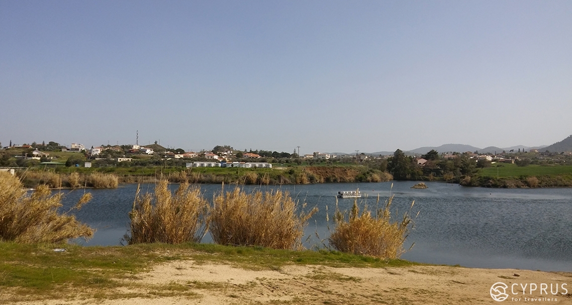
The reservoir [1] — lying to the right of the bridge and leading to Klirou — is a quiet spot, which you could almost deem a “relaxation zone”; this was evidently planned, as crushed stone has been laid in the car park by a fenced entrance and benches have been set up, with trees and ornamental shrubs planted… While to the left — you have the “Malounta” Dam (an earth-fill dam constructed in 2007): in the months when the reservoir (with a volume of close to 2 million cubic metres) is full, its waters cascade over the sides, at a high of 38 metres — an unforgettable scene, which you can observe from the bridge!
Although the main exit onto the waterfront was closed, we discovered an “opening” in the fencing to the side. From there, we began to stroll along the water’s edge. The whole bank was overgrown with tall, thick reeds. Along the pathway, you could see thickets of rosemary which had already broken into a luxuriant, purple blossom, attracting a large number of bees buzzing around in a business-like manner, amidst the bright sun.
Now the springtime water level is rather high, so when looking from the bridge, it seems as though you’re driving through a large, natural lake: the rough coastline adds further charm to these areas.
By the way, if you’re looking to come to the reservoir for a break, be careful: since the body of water is artificial, it’s worth remembering that there are practically no shallow-sloping areas (except for the exit along the embankment by the gates) and it immediately deepens straight away, as soon as you set out from the bank itself.
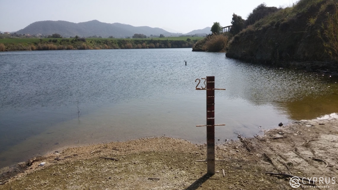
Aside from a beautiful, wide vista to the opposite shore, where the village is situated, there’s also a rather curious marking here: a metallic post to measure the water level, marked with the number “23”, and a second one, ten metres away, with the number “22”.
I wonder if it’s possible to catch fish, and what would you expect to find? On this occasion, no matter how much we peered into the dark-green depths, while the water’s surface rippled in gusts of fresh wind, we didn’t notice any sorts of floating critters.
Klirou
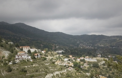
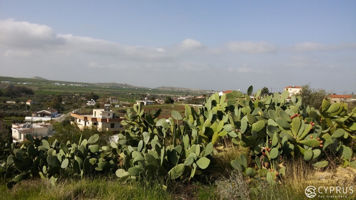
So, head south-west from Nicosia for 26 kilometres, towards Palaichori and Agros. After turning off the E904 motorway and passing by the E903 for Arediou and Malounta, you’ll find yourself in the village of Klirou (with an area of 18.7 square kilometres)and surrounded by scenic hillsides.
At present, close to 1700 locals live in the village, which possesses a predominantly mild climate, with a low level of annual rainfall. On average, Klirou stands 450-470 metres above sea level. The highest hill in the settlement limits is the “Vournia” summit (at a height of 717 m). The wooden bridge located here recently became part of the list of UNESCO world heritage sites (registered as number 1679).
In Klirou and the surrounding areas, archaeological finds testify to the village’s existence since ancient times.
The village of Klirou is situated in the northern section of the Troodos foothills. Close by lies a large number of ancient ruins and burial sites, where numerous artefacts have also been discovered from the Archaic, Classical and Roman period. It was initially inhabited in the late Bronze era by Greek migrants, settlers from Arcadia; the village later formed part of the ancient kingdom-polis of Tamassos [2], the vicinity of which was well-known for its multiple tunnels and mining pits (as well as for metal-processing).
Based on evidence from the historian and geographer Strabo (his “Geography” in 17 tomes has survived to our time), silver mining was well-developed in Tamassos: nearby Aetovrisi and Kouloupades. During the Roman Empire, the Cypriot metallurgical industry was under the control of Roman governors (procurators).
-
In official Cypriot sources, the first references to Klirou are from the 14th century (Frankish rule).
Interestingly, from around the 5th century, including the rule of the Ottoman-Turks (until 1878, when control of Cyprus transferred to the Supreme Commissariat of Great Britain, while the country still technically remained part of the Ottoman Empire), the name “Klirou” referred not only to one village, but to a whole “complex”, totalling more than a dozen neighbouring hamlets and villages. At that time, the island’s Muslim population inhabited several of them.
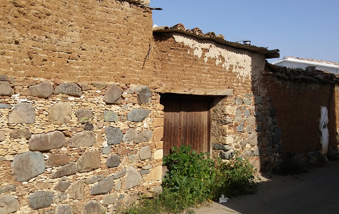
In the antiquity, this was a genuine centre for industry, with water from the local river, accessed through underground pipelines, serving as a production supply. After several outbreaks of disease ravaged the island, some of the survivors were forced to leave their settlements hurriedly and many settled in Klirou, Malounta or Arediou.
And yet, today’s Klirou, located on an intersection of many roads and routes in Cyprus, including those used for trade, was the most preferred settling spot for those who had endured the epidemics. Moreover, accounts have been preserved stating that this village, in particular, was used by local priests to educate children: after all, in the centuries of Turkish rule, education was only accessible to a small few, and the question of whether the island’s population would receive it, remained undecided.
In 1884, the first municipal school in Klirou was founded.
-
Several versions exist relating to the origin of the village’s name, all of which are worth noting.
The village's name is known to have appeared precisely around the year 392 when the settlement was transformed into a military camp. It was also used as a centre to disseminate Christianity (the same era as when the famous churches of Apollo in Malounta, as well as the neighbouring churches of Dionysus, were destroyed).
So, the scientific version says: according to a law aimed at combating “relics” of paganism, every person wishing to live there had to declare themselves before a cleric as Christian, for the right to own land and property.
The name of the settlement “Klirikou” is considered to have originated namely from the commonly used phrase: “…we’re going to the Clerics (Klirikou)". This name subsequently transformed into Klirou.
The second version states that most of the village’s men once entered into the Church, while some became monks; and having become clerics, they had effectively gained the ability, as they believed, to withstand epidemics and protect the rest of their people through spiritual intercession.
Finally, the third version is more poetic and one based in folklore: it is indebted to a bird nicknamed a “klorkos” due to the noises it emitted, which were distinctly resemblant of the sound: kliro-kliro.
And here we are…
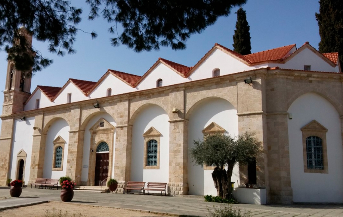
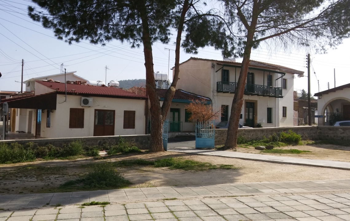
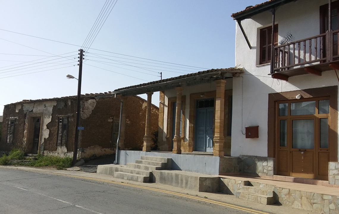
The village — which is no less impressive in comparison to the three others we have visited today: Arediou, Malounta and Agios Ioannis — has a beautiful, spacious central square, where you can leave your car to go for a look around.
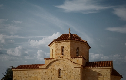
In the centre aptly stands a tall, ancient, stone church, with a high carved bell tower, — the church of Panayia Evangelistrias (1890, the extension completed later is attributed to the year 1904). Nearby you can find a monument under construction dedicated to the memory of 5 villagers who went missing during the Turkish occupation. It differs from many other similar monuments, where busts are usually cast in memoriam of missing and fallen heroes. Also, а stella may sometimes be installed, made of dark marble or granite.
Here the artist has symbolically portrayed those to whom the monument is dedicated by creating portraits carved in a deep relief onto a large stone sphere. A metallic funnel leads out of the sphere, ending by the “gaping” Cypriot earth under the glass…
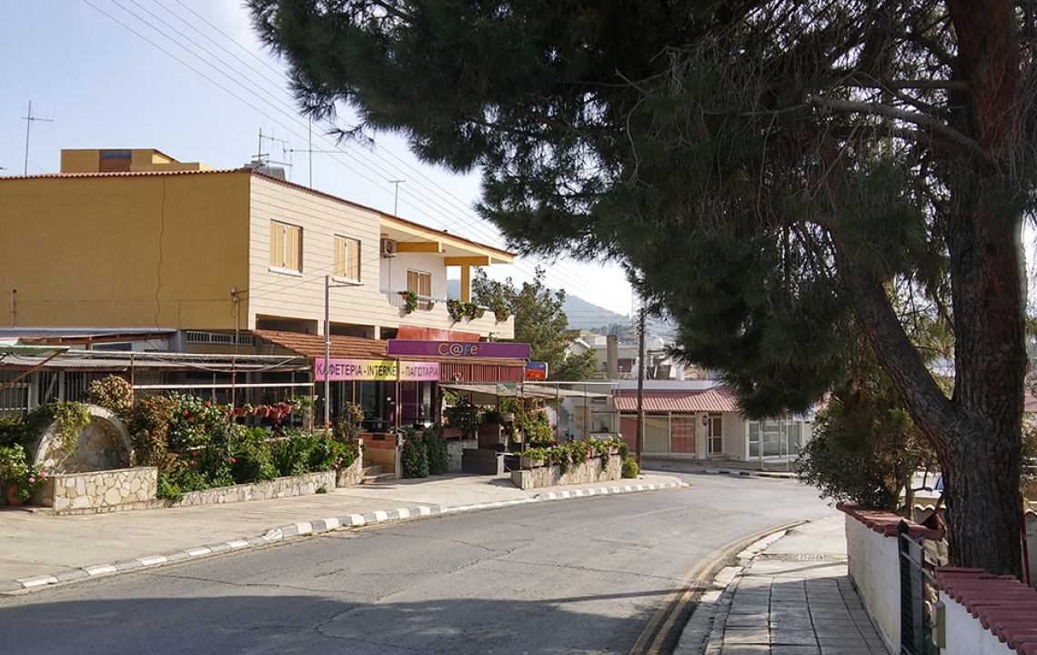
Around the square, not too far away from the church, you can notice a post office, a couple of small shops, a coffee shop and of course, a Sunday school for the local community.
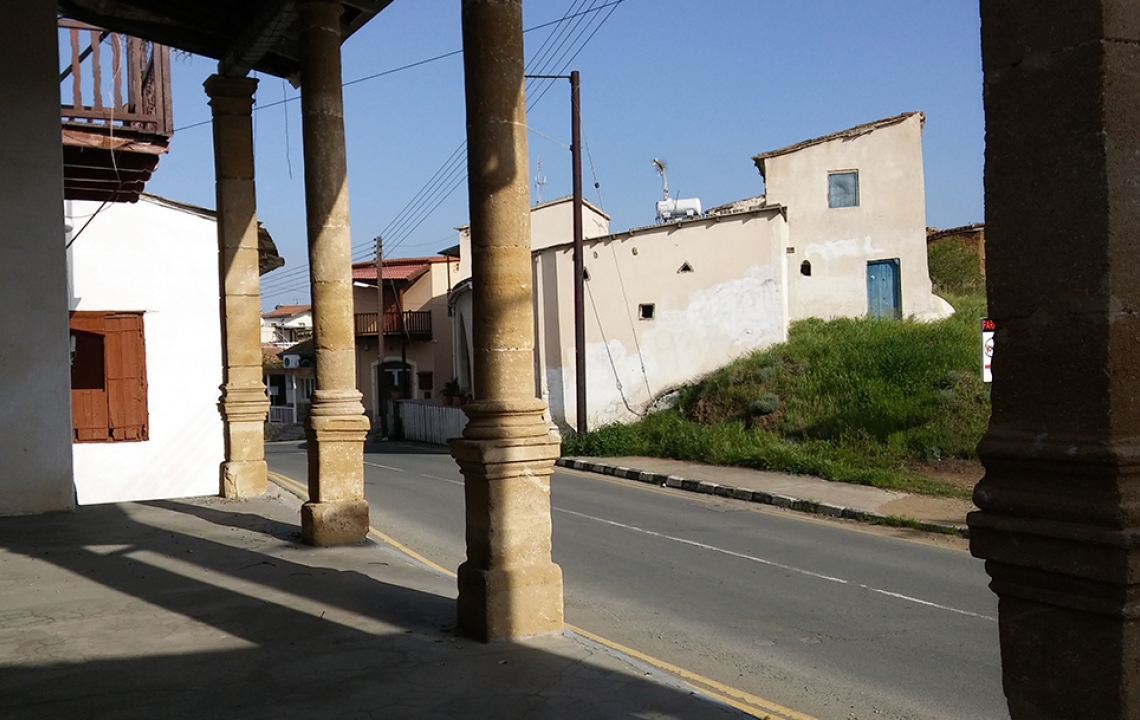
On the whole, the developments around the church, if not ancient, are particularly old, — they are classical for Cypriot villages and therefore look very appealing. Besides this, there is a small alleyway, leading to a restaurant here, covered in small paving stones. The paving is something resemblant of a ceremonial road.
Throughout the history of Klirou, only Greek Cypriots have inhabited the village, but they have gladly formed mixed groups, befriending and on occasion playing with members of the Cypriot Turk community from other villages. We found this out while there…
While feasting our eyes on the views of the reservoir, we met the owner of a local house. It stood on a hill summit with a nearby vista of the Troodos. The silhouettes of the mountain foothills became blue in the sun’s haze, towering over orchards and roof houses.
Soon after treating us to a large and delicious strawberry from her allotment, Ms Elena took her time in telling us:
“it truly is splendid here: the village is green; fortunately, there are no snakes (she laughs: so you don’t need to be scared!)…
The water from the reservoir doesn’t go to us, but other villages situated lower: Palaiometocho, Meniko… we were the ones who built the dam.
There used to be only fields here, with far fewer homes on the outskirts.
A Christian population has always inhabited Klirou, never Turks.
We once had a flour mill here, and Turkish Cypriots from Arediou and Deftera would come here rather often to grind wheat.. as well as to order new clothes for themselves and their family members. Our village is renowned for the high number of skilled tailors living here!
You see, people used to live very well and in peace! Children from various communities would often play with each other — not like now: everyone sits at home with their gadgets, you know?
I think, when times changed, people began to experience more problems!”
This hospitable woman then told us that not only were they preparing for the upcoming opening of the monument we had seen on the main square, but also of a Museum dedicated to everyday folklife. Well, we shall have to wait and see!
Here is an elderly resident who remembers and knows their village well. Amongst the relatively new sources, we’ve found some accounts and details about Klirou which are of particular interest today.
For instance, George Jeffery [3] (George Jeffery, F.S.A. – Architect – 1918), who we already know from previous publications, writes the following:
“Klirou. A large village from whence a good mule path leads to Lakhni monastery… and continues through a delightful valley to Makheras monastery.
All Klirou's churches or chapels, of which there seem to have been several, have disappeared. In their place, a large, new church is now under construction, dedicated to the Panayia Evangelistria. Icons from the old chapels have been gathered here, as well as a collection of more or less decayed specimens of Byzantine painting from all periods of the empire’s existence. There is also an iconostasis consisting of three old, carved, gilded tiers [works] of outstanding craftsmanship, which are worth examining. One of them dates back to the year 1741…”
The notes of the British traveller, Rupert Gunnis — «Historic Cyprus», are also of interest:
“Klirou… There must have been habitations here from a very early date, as the vast numbers of tombs which surround the village testify. The large and modern Church of the Virgin Mother… stands in the centre of the village; … you can still see its predecessor to the north. The central portion of the iconostasis comes from this former building and is dated 1748. From the same source comes an early seventeenth-century icon of the Madonna.
A mile or so outside the village is the tiny monastery of the Virgin of Lakhni, a small, ancient, shed-like building surrounded by monastic ruins; it contains nothing of interest.
The villagers relate that “many years ago the Turks came from the village of Arediou in mid-July; but hardly had they left the building when the Virgin, in her wrath, sent hailstones so large that they immediately killed the animals bearing the woodwork”.
Lakhni monastery and more concretely, the church-chapel of Panagia-tou-Lakhni (also Panagia Chryseleousa) links to another local legend.
It is said that during the Arabic invasion of 650-700, when part of the aggressor army was in the region of Pitsilia, soldiers were caught in a fearsome storm nearby Klirou… their commander, having taken several people with him, sought shelter in the semi-destroyed Lakhni chapel.
Sensing the sanctity of this place, this wise person vowed to restore it, should he live out the storm. Not only did he subsequently fulfil his oath, but began to revere the chapel, making regular visits to it.
Klirou: Going Round in Circles, or Worth Learning More
A bicycle route has been built here, spanning from Nicosia to Pitsilia (115 km long, developed by CTO [4]). See here for more details.
“The growing fields”: accessible in spring, located outside of Klirou, in the direction of Fikardou.
If when continuing your journey, you don’t just use our advice and decide to involve other neighbouring villages, then a magnificent spectacle awaits you along the way: wild roses blooming in the meadows; this takes place specifically in March, in combination with white clouds of almond flowers — a truly unforgettable sight!
Amongst other things, March is the time when the annual (and all things similar) Blooming Almond Trees festival is held in Cyprus.
The ceremonies, supported by STO, are held in the village of Limnatis, on the outskirts of Limassol (we’ll get there one day). The programme includes traditional Cypriot folk dancing, cooking and trying traditional Cypriot cuisine, as well as an exhibition-fair of folk crafts.
The Almond in Cyprus
In general, I don’t think it’s a cardinal sin to watch almonds blossoming in other populated areas — after all, Messaoria valley, like some other regions on the island, has whole groves full of almond trees, which are of genuine beauty and one of the reasons why the valley is renowned for this product.
Soon we will set out for one of the villages in the Troodos foothills: Palaichori — an incredible and scenic spot nowadays, which is also famous, just like Klirou, for almond cultivation.
The almond tree (interestingly from the plum family and therefore not a nut) has a long life span (up to 100 years), preferring sunny areas, with no fear of droughts; it grows on stony slopes rather high above sea level. Although, in many countries, it is usually harvested when ripe in August, in Cyprus, even green (soft) almonds are used everywhere in May.
Ground, fried almonds are an integral ingredient in many Cypriot desserts. In fact, gardeners wishing to plant almonds in their garden are advised to buy two trees at once: for cross-pollination is required to produce a good yield (for more information, see here).
How to get there:
Driving from Nicosia: to the village of Klirou (a 42-minute journey) through Arediou (36 minutes), Malounta and Agios Ioannis (39-40 minutes) — go along the B9 highway (continuing on the E903 — also Griva Digeni street) coming off to the left at the sign for the E904.
By bus: the 100, 127 and 250 operate routes to the village. See here for more information.
-
Information: www.cyprusisland.net, www.klirou.com
Email: info@klirou.com
Address: Village Management (Dipokratias 3, Klirou)
Telephone: +357 22633344, +357 22633898
A beneficial resource for all lovers of agro-tourism, see here: www.mapquest.com.
Stay with us and see you next time!
[1] Official name “Klirou – Malounta – Akaki”.
[2] The exact origin date of the polis, which paid a vassal tax to the Assyrians, is unknown. The following words, however, can be found in the great Homer’s “Odyssey”: “…I’m sailing to the strangers for copper, to the faraway city of Temese…”; references are also made to Tamassos by the philosopher Stephanus of Byzantium (VI century).
[3] J. E. Jeffery is famous for his journals and detailed descriptions of statues from the antiquity in Cyprus, which were published in 2009 in Nicosia (publication of the Department of Antiquities) and edited by Despina Pilides.
From 1908-1912, he was responsible for overseeing construction of the Cyprus Archaeological Museum and went on to be its curator.